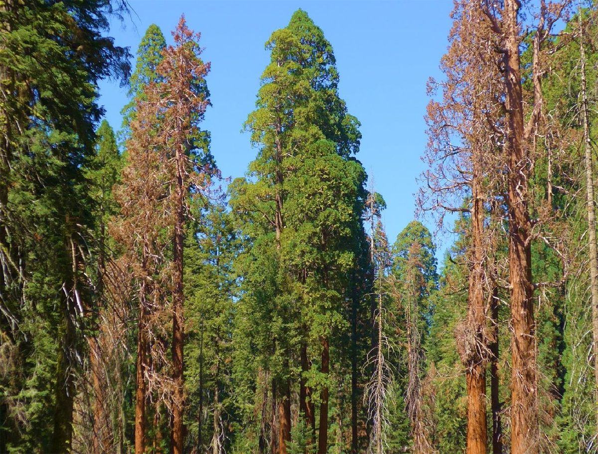
Dead giant sequoias among living ones. Photo: N. Stephenson, USGS
|
Giant sequoias have stood for thousands of years, and some of the most iconic trees are now dying.
AI for Giant Sequoias develops AI tools that automate forest survey and monitoring. We combine high-resolution satellite imagery with linked ground observations to bring individual tree monitoring to the landscape scale. Wildbook helps researchers follow individual animals, and this project applies the same idea to individual trees. |
The Threat
Tiny native bark beetles are now killing millennia-old, iconic individual trees in as little as 18 months. Spotting stressed trees early, across whole groves, is the key to protecting them.
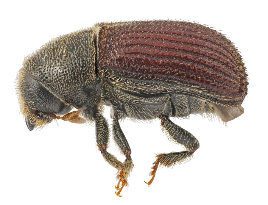
A native bark beetle (Phloeosinus). Photo: Joshua Dunlap, Oregon Department of Agriculture
|
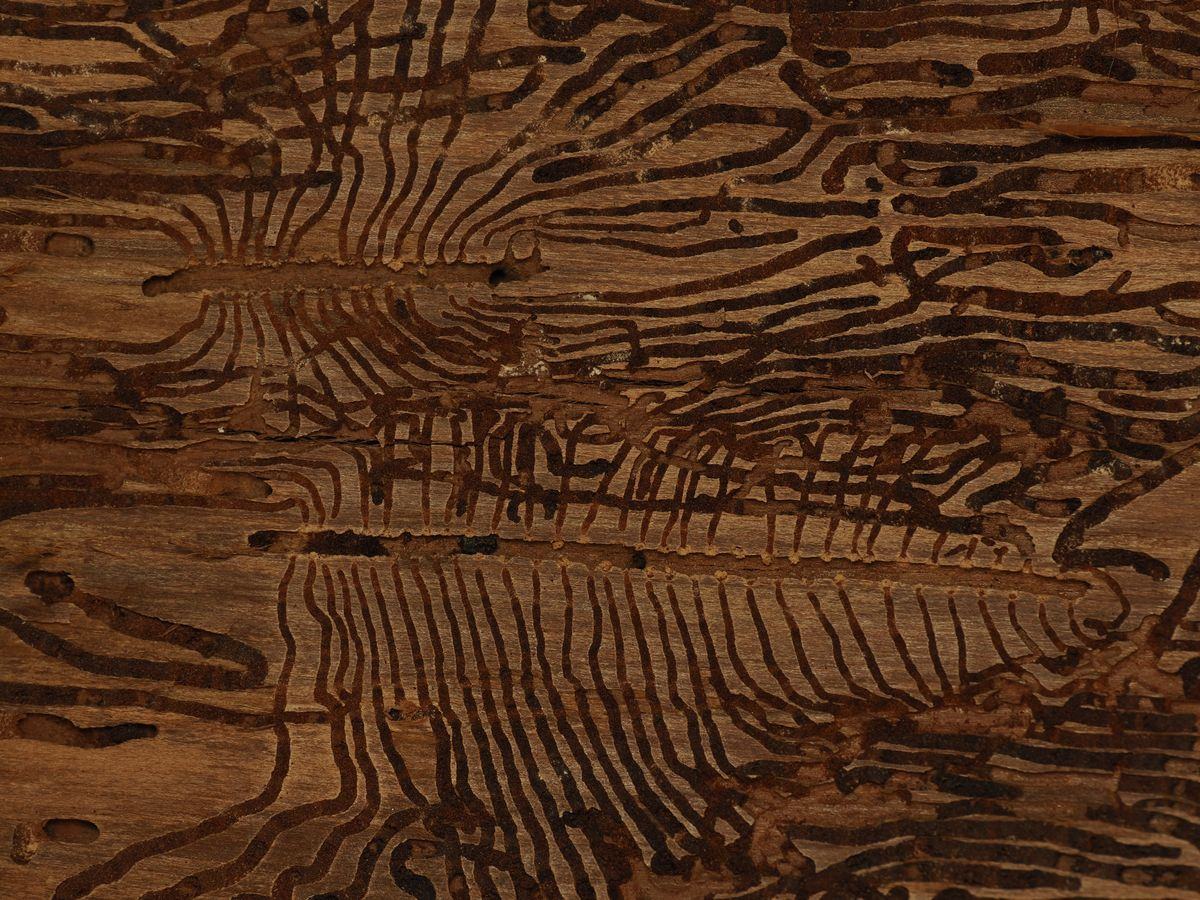
Bark beetle galleries. Photo: Nick Ampersee
|
Our Goals
|
1. Count and inventory every giant sequoia.
Map each tree from space so every sequoia has a record. 2. Count and inventory every dead and dying tree. Track losses from beetles and fire across whole groves. 3. Monitor tree health continuously. Build an ongoing health monitoring system that flags trees potentially threatened by beetles at the earliest possible stage. |
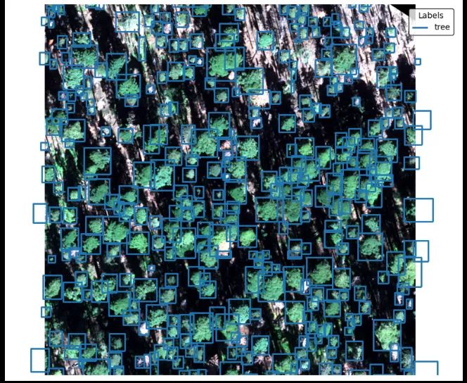
Hand-labeled tree crowns used to train our models
|
What We Have Done
50ktree crowns localized
3k+mature sequoias identified
7k+spiretop sequoias identified
1.6ktop-down threat cases flagged
|
Dataset
• 8 groves labeled: Redwood Mountain, Giant Forest, Redwood Meadow, Muir, Oriole Lake, Lost, Garfield, and Cedar Flat • More than 40,000 hand labels across 7 classes: tree, mature sequoia, spiretop sequoia, top-down threat, fire damage, dead, and healthy • Diverse conditions: topography, seasonality, sun angle, and sensor geometry |
Models and tools
• A general tree crown detection model for 0.3 m Pléiades Neo satellite imagery • Two crown classifiers, one for species and one for health • A QGIS plugin for end-to-end inference • Independent species and health probabilities across high-concentration sequoia groves |
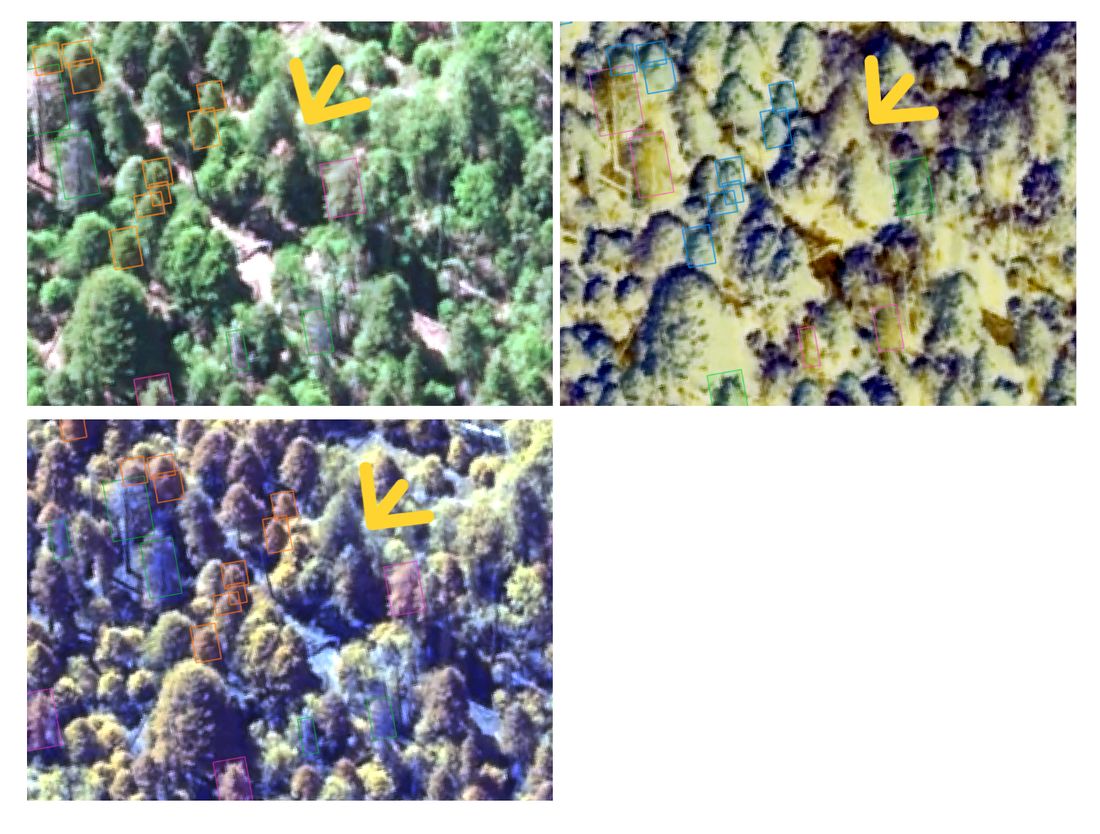
Top-down threat cases: crowns declining from the top, flagged in satellite imagery (arrows)
AI for Individual Trees
|
What if every tree could be a “sensor” for invasive species, diseases, investment risk, and fire?
The problems we are working on • Ground-based sampling for pests and pathogens is limited and disconnected • High-resolution forest health monitoring is missing across large landscapes • Coordination is lacking across public, private, industrial, and tribal lands • Remote sensing is still too expensive Our approach We link diverse industries, researchers, resource managers, and data types. That supports multimodal observation for predicting high-severity fire, assessing risk, and detecting pests and pathogens early. |
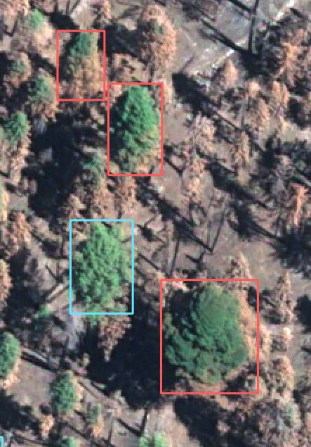
Mature sequoias with fire damage
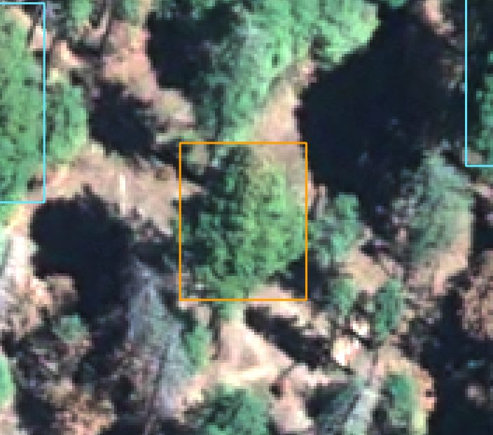
A mature sequoia flagged as a possible bark beetle threat
|
A “CARFAX” for Trees
Every car has a history that many industries rely on. We think individual trees can work the same way.
|
Industries linked around individual cars
• Departments of motor vehicles • Manufacturers, auctions, and dealers • Insurance companies • Service and repair facilities • Law enforcement and fire departments |
Industries linked around individual trees
• Cities and urban forestry • County, state, and federal resource managers • Commercial forestry • Insurance • Individual property owners • Arborists • Nonprofits |
The goal is opt-in, multimodal business intelligence about individual trees, and about the benefits and risks they bring, for all of these groups.
What We Are Doing Now
We are building a user interface for targeted survey workflows. The prototype has confidence sliders for species and health, a queue of anomalies ranked by probability, and a panel for reviewing the satellite imagery.
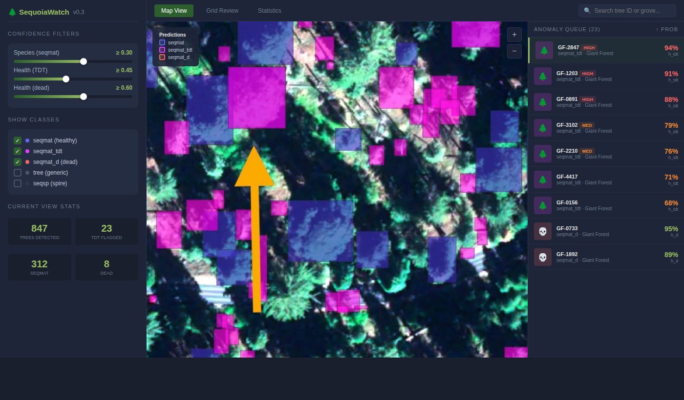
Survey interface prototype
Funding, Support, and Partners
|
Funding and support
• Patrick J. McGovern Foundation • Airbus Foundation • Connected Conservation Foundation • Microsoft AI for Good Research Lab Partners • U.S. Geological Survey (USGS) • National Park Service (NPS) Interested in collaborating? Contact us. |
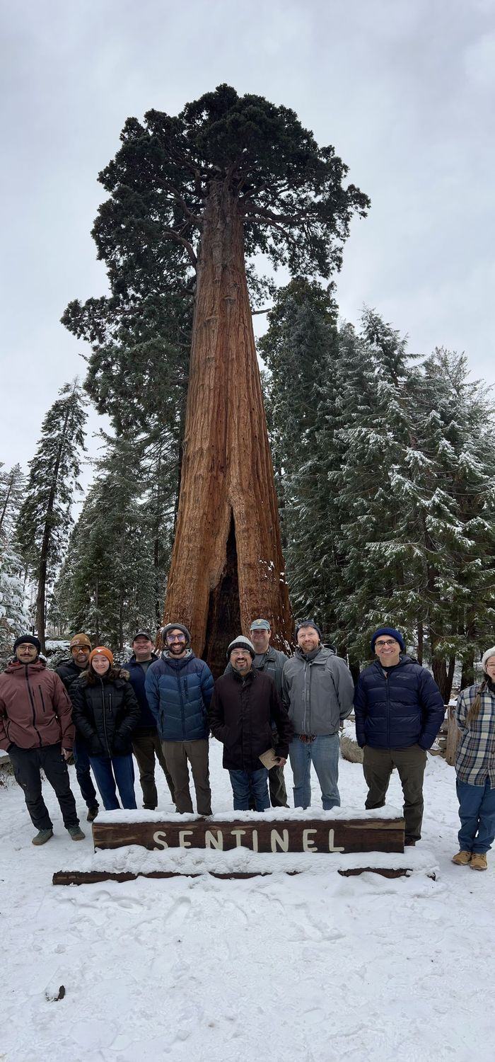
The team at the Sentinel Tree, Sequoia National Park
|
Satellite imagery: Pléiades Neo © Airbus DS.
